TransPhoto

Zdjęcia publikowane są w stanie rzeczywistym i nie mają na celu promowania żadnego stanowiska politycznego i/lub ideologicznego.

Wszystkie materiały są dostarczane przez użytkowników i nie odzwierciedlają opinii zespołu administracyjnego witryny.

Zamknij
Halberstadt — Maps • Netzpläne
  HalberstadtMaps • Netzpläne

Przysłał Ymtram · East Haven - Branford           Data: 1910 r.

Statystyka

Opublikowano 04.10.2020 08:06 MSK
Odsłon — 613

Dokładna informacja

Parametry zdjęcia

Pokaż cały EXIF

Komentarze · 1

04.10.2020 16:07 MSK
Link
focus1965 · Antwerpia
Zdjęć: 8812 · Zastępca administratora / Tłumaczenie strony (EN/FR)
This map shows an interesting detail. Someone from the Netherlands, who collects tickets, has made an interesting study about this.
The older tickets (in Germany, but also elsewhere) showed a scheme of the line in question, where (almost) all stops were indicated. So the conductor simply had to tick where they had boarded and where they wanted to get off.
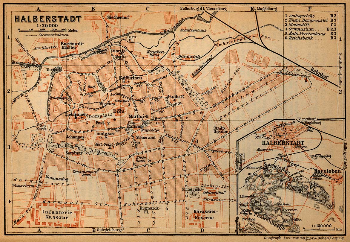
The map clearly shows the barracks (even with name) and there is a good chance that a nearby stop had the same name. Due to the threat of war, all barracks suddenly disappeared from all maps... and tickets: they were renamed. This happened several times (according to that study): the stop could first be given a 'beautiful' name (peace), or the name of a known (usually revolutionary) person, and later be renamed to something else, ranging from 'football' to the name of a nearby street. This process could happen in any direction - and has happened, mostly before, during and after the war.
History repeats itself: on Google maps, barracks are now also being blurred...
+3
+3 / –0

Twój komentarz

Zabronione są rozmowy o polityce (karą jest ban na 1 miesiąc)
Nie zalogowałeś się na TransPhoto.
Komantarze mogą wystawiac tylko zarejestrowani użytkownicy.