


 Городской электротранспорт
Схемы
Кёнигштайн
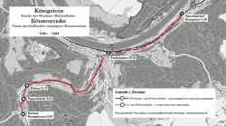 |
Карты, созданные с использованием OpenStreetMap Кёнигштайн 16 февраля 1902 г. |
Показано изображений: 1 из 1
Фотографии отсортированы по дате съёмки, вверху самые новые.
Тёмная тема
© Администрация ТрансФото и авторы материалов, 2002—2026
Использование фотографий и иных материалов, опубликованных на сайте, допускается только с разрешения их авторов.
Использование фотографий и иных материалов, опубликованных на сайте, допускается только с разрешения их авторов.