


 Pilsētas elektrotransports
Maps
Munich
 |
Alternative Map of Munich Underground and Suburban Trains (Sark Version) 15 decembri 2024 g. |
 |
Alternative Map of Munich Underground and Suburban Trains 15 decembri 2024 g. |
 |
Liniennetzplan Straßenbahn München, gültig 2024 • Схема трамвайной сети Мюнхена, действует в 2024 году • Scheme of tramway network in München, valid in 2024 2024 g. |
 |
Tramnetz München 21 septembri 2019 g. |
 |
License CC-BY-SA 2.0 Decembris 2018 g. |
 |
Схема трамвайного сообщения / Schema Straßenbahnlinien 2014 g. |
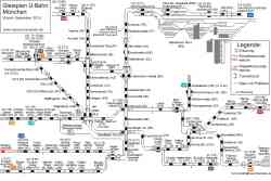 |
Схема путевого развития Мюнхенского метрополитена Decembris 2010 g. |
 |
U-Bahn — Miscellaneous photos Schema der Integration des Transrapids in den Münchner Hauptbahnhof • Схема интеграции Трансрапида в центральный вокзал Мюнхена • Diagram of the integration of the Transrapid system into Munich Central Station 2008 g. |
 |
Transrapid project Munich Central Station — Airport (2000 — 2008) Geplante Streckenführung des Transrapid • Планируемый маршрут Трансрапида • Planned route of the Transrapid 2000 g. |
 |
License CC-BY-SA 2.0 1997 g. |
 |
License CC-BY-SA 2.0 1964 g. |
 |
Map of the Munich trolleybus network, consisting of the solo Line 032 (later 58). 25 oktobri 1959 g. |
 |
License CC-BY-SA 2.0 1914 g. |
Dark Theme
Vietnē publicēto fotogrāfiju un citu materiālu izmantošana ir atļauta tikai ar viņu autoru atļauju.